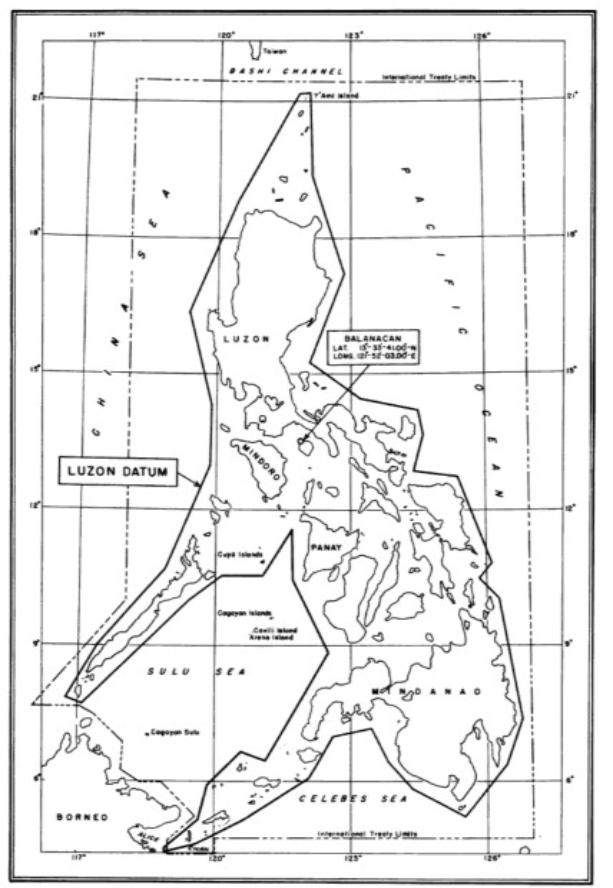
| Luzon Datum Balanacan Station The center point of the Philippines |
| Historical Background The triangulation in the Philippine Archipelago developed along the same lines as the triangulation in the United States. Military and commercial considerations necessitated the beginning of work at different points throughout the islands, each control scheme being on its own geodetic datum as determined by astronomic observations connected with that particular scheme. Later these surveys were brought together on what was known as the Vigan datum. This datum answered the purpose for a time, but as the triangulation was extended to the south and embraced additional astronomic stations, it was found necessary to establish a new datum so that no serious errors would occur in any part of the system. The Luzon Datum This datum was adopted in 1911 and received its name from the fact that it is derived wholly from observations on Luzon Island, although supplemented by theoretical inference and approximate results from other regions. While this was an attempt to establish a Philippine datum, the incompleteness of the available data made it unwise to adopt the latter name. The Luzon datum is defined in terms of the coordinates of Station Balanacan in Marinduque Province as computed on the Clarke Spheroid of 1866 as follows: Latitude: 13 degrees 33 minutes 41700 seconds North Longitude: 121 degrees 52 minutes 03700 seconds East Azimuth to Baltazar: 9 degrees 12 minutes 37700 seconds |
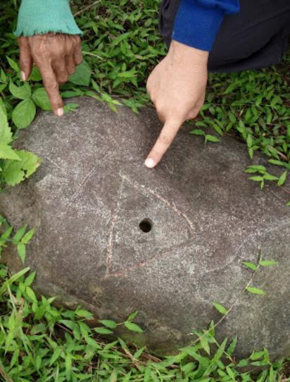
Balanacan Station Description: Station mark is the center of a
hole 1.5 cm in diameter and 6 cm deep, drilled at the center of a
triangle 16 cm on a side, cut in a hard rock.
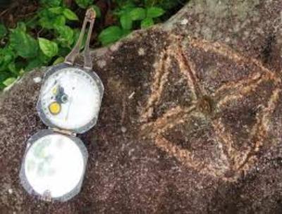
Reference mark is on a hard, white boulder of about one cubic
meter in volume, standing 80 cm above the ground and 90 cm
higher than the station. The mark is a hole 1.5 cm in diameter
and 8 cm deep, at the center of a cross cut on top of this stone.
From the station, the reference mark is in azimuth 326 degrees,
34 seconds and is distant 18.85 meters.
hole 1.5 cm in diameter and 6 cm deep, drilled at the center of a
triangle 16 cm on a side, cut in a hard rock.
Reference mark is on a hard, white boulder of about one cubic
meter in volume, standing 80 cm above the ground and 90 cm
higher than the station. The mark is a hole 1.5 cm in diameter
and 8 cm deep, at the center of a cross cut on top of this stone.
From the station, the reference mark is in azimuth 326 degrees,
34 seconds and is distant 18.85 meters.
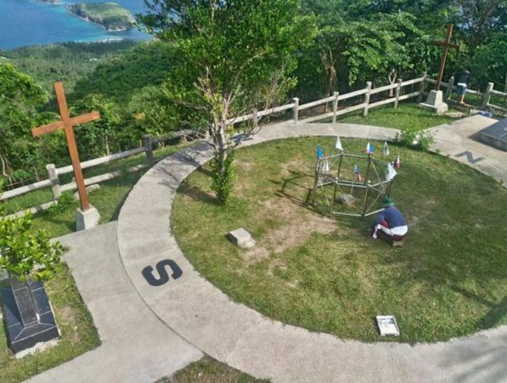
| Balanacan (Marinduque Province, O.W. Ferguson, 1906, 1907). On the highest hill at the northeast point of Marinduque Island. Salvaria Islands in the entrance to Looc Bay bears N. 9 degrees E., distants 3 kilometers, and the highest point to the western one of the two San Andres Islands bears S. 80 degrees E., distant 3 kilometers. It is on the northwest end of the hill, 10 meters northwest of the highest point, and is in a commanding situation, seeing a hundred miles of the south coast of Luzon, much of the north and west coast of Marinduque, the coast of Mindoro and other islands. |