| Marinduque Maps |


Upper right corner, Port San Andres (Balanacan).
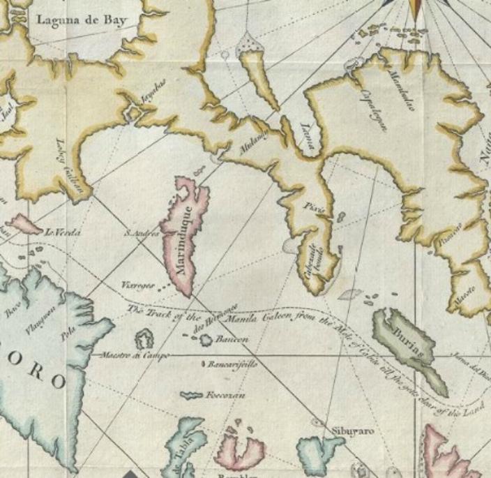
1760s -Captain Brereton
1760s -Captain Brereton
Malaspina Expedition 1789-1794 Coastal perspectives of the
Bantón, Bantoncillo and Marinduque Islands, located in the
northern part of the Sibuyan Sea (Philippines)
Bantón, Bantoncillo and Marinduque Islands, located in the
northern part of the Sibuyan Sea (Philippines)

Early 1900s map showing size comparison of Philippines the United
States
States

Japanese Map of Marinduque. Unknown date, it appears the Japanese took
a early map of Marinduque (1900-1920) and added names and notations in
Japanese. If you look carefully at the map you can read in English
(Marinduque sub province)
a early map of Marinduque (1900-1920) and added names and notations in
Japanese. If you look carefully at the map you can read in English
(Marinduque sub province)

| 1899 Manila Observatory Map #10 Tayabas Province Place Names are in Spanish |

| Unk year showing domestic and international shipping routes |


| 1875 Japanese Map |